Loading...

Digital aerial photography as a basis

Orthophotos, 3D models, multispectral and thermal images are the basis for all new construction, renovation, maintenance and servicing projects.

Reto Weiss

Models, maps and photos are available to all participants in the cloud. This makes communication with management and employees much easier.

Roland Berger

Making the hidden visible and identifying the connections. With this knowledge, the consumption of water, fertilizers and pesticides can be decisively reduced in times of climate change.
Erich Steiner

Sensors

With specialized cameras things become visible that cannot be seen by the naked eye.
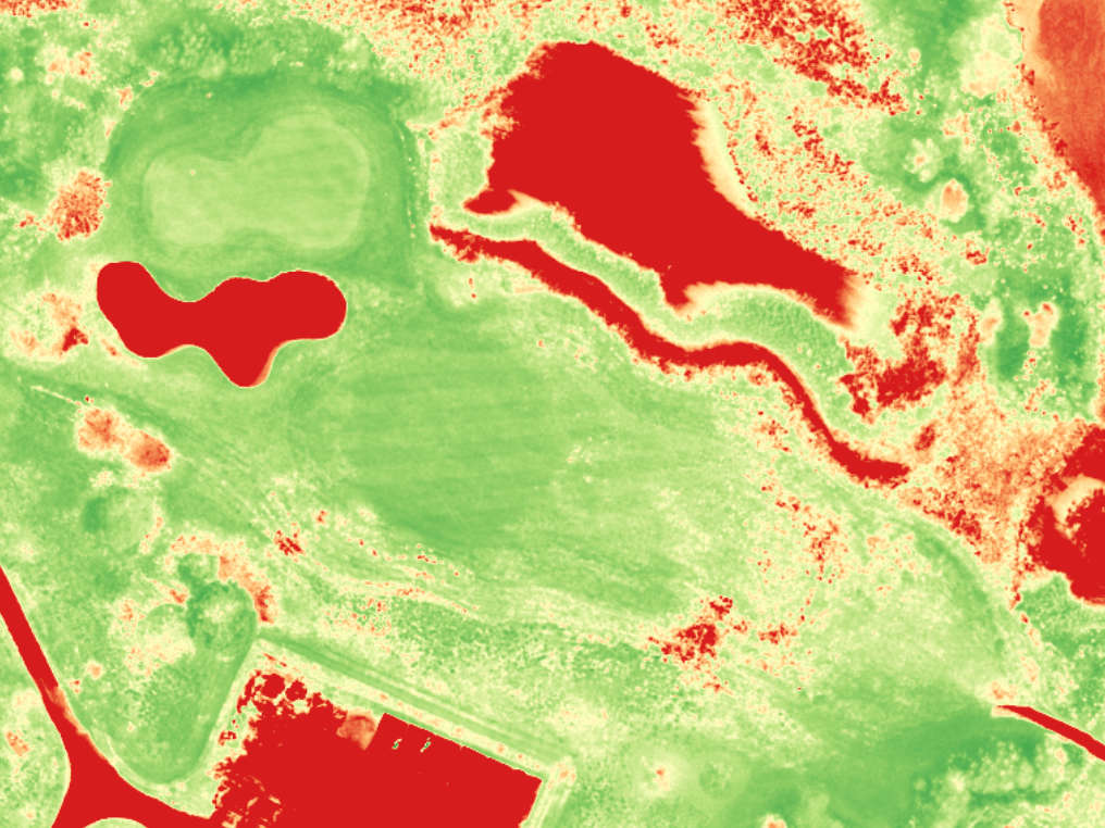
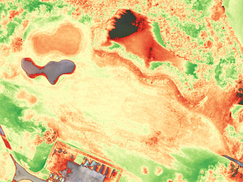
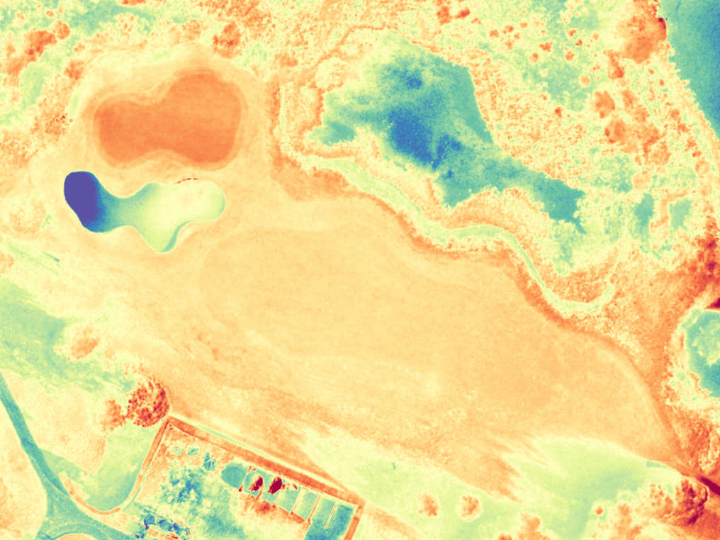
Multi-spectral cameras measure visible and invisible light. Areas where lawns and other plants suffer from stress can be made visible with vegetation indices such as NDVI or NDRE.
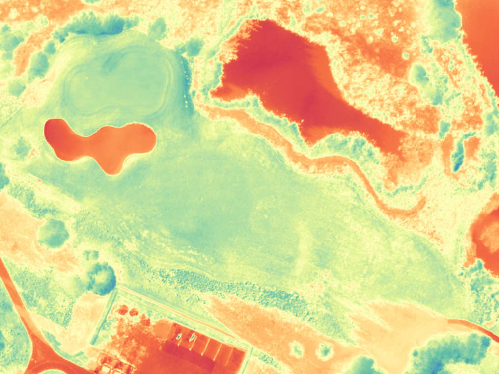
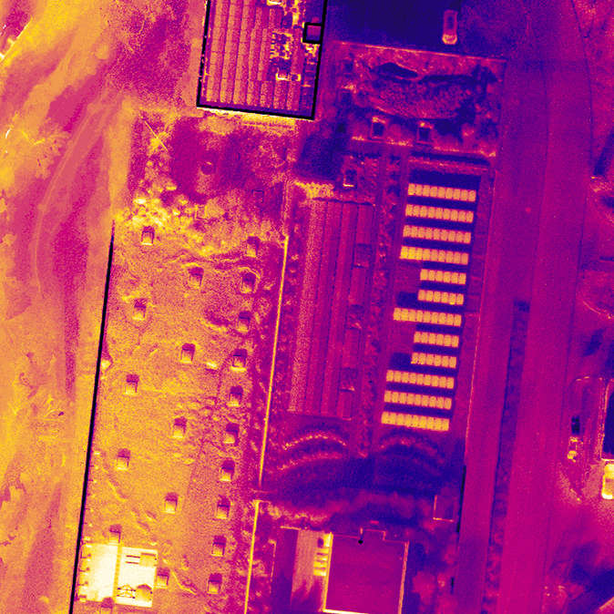
Thermal cameras provide information about heat distribution on the ground or on roofs and other building structures. Among other things, zones with increased evapotranspiration can be determined.
RGB cameras provide images with which 3D terrain models (DSM, DTM) can be created using photogrammetry.
Sensoren die NDVI und andere Vegetations-Indexe berechnen können.
Sensoren die Thermal-Bilder aufnehmen können.
Sensoren die normale RGB Bilder erstellen können.

Services

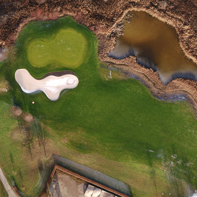
The operation and maintenance of golf courses and sports grounds is changing rapidly with the use of drones. With the help of aerial photos you can see facilities from a bird's eye view and undetected patterns suddenly become visible. We photograph the facilities, virtualize them, create up-to-date plans, measure the entire golf course and sports ground, and make the invisible - visible. This new technology is radically changing the way that a facility is maintained and presented. Managers, greenkeepers and groundskeepers will always have the most up to date site data and not have to rely on old out of date plans. Professional marketing plays an extremely important role in the growth and development of professionally operated golf and sports facilities. Fly-over videos (e.g. on websites) can be used to advertise the facilities from a completely different perspective.
Our work
  • Recording of golf and sports facility with a flying robot (drone)
  • Virtual fly-over of the entire course incl. gastronomy, driving range and golf academy
  • Tee-to-Green Fly-over for every course
  • Data storage in a cloud-based data portal
Your benefits
  • Independence from plans – know what is, not what was planned in the past.
  • Always up to date with the possibility to plan ahead of time.
  • Use of aerial photographs with a very high resolution, and with 100% accuracy of visible objects.
  • Orthophotos offer an excellent overview as poster, PDF, on the web/cloud:
    • For internal and external communication
    • For a golf course guide and score card
    • For planning
    • For operation and maintenance
  • For visualization of elevation or terrain models
    • 3D views of the golf course or sports ground (Digital Elevation Maps - DEM)
    • For planning and renovation
    • Volume calculations (cut and fill)
    • Identifying erosion and flood prone areas at a glance
  • 3D models:
    • Perfect visualization locally on the PC or in the web/cloud
    • Professional means of communication with investors, management and customers
    • For contemporary marketing (virtual tee-to-green Fly-over, on the web for members and guests)
  • Advertising on local television

Our Team

Turfview, is a partnership between pixmap gmbh and Steiner & Partner Landschaftsarchitektur GmbH, working every day with passion and innovation.
Reto Weiss

Welcome!

Reto Weiss
Pilot & Data Processing Scientist
Roland Berger

Glad, you are visiting us.

Roland Berger
Pilot & Data Scientist
Erich Steiner

Let us know how we can help.

Erich Steiner
Golf- and Sport Turf Specialist
Roman Lampart

Take your time and look around.

Roman Lampart
2D und 3D terrain modelling
David Bily

Questions? Give us a call.

David Bily
Golf Course Architect

Vegetation Indices

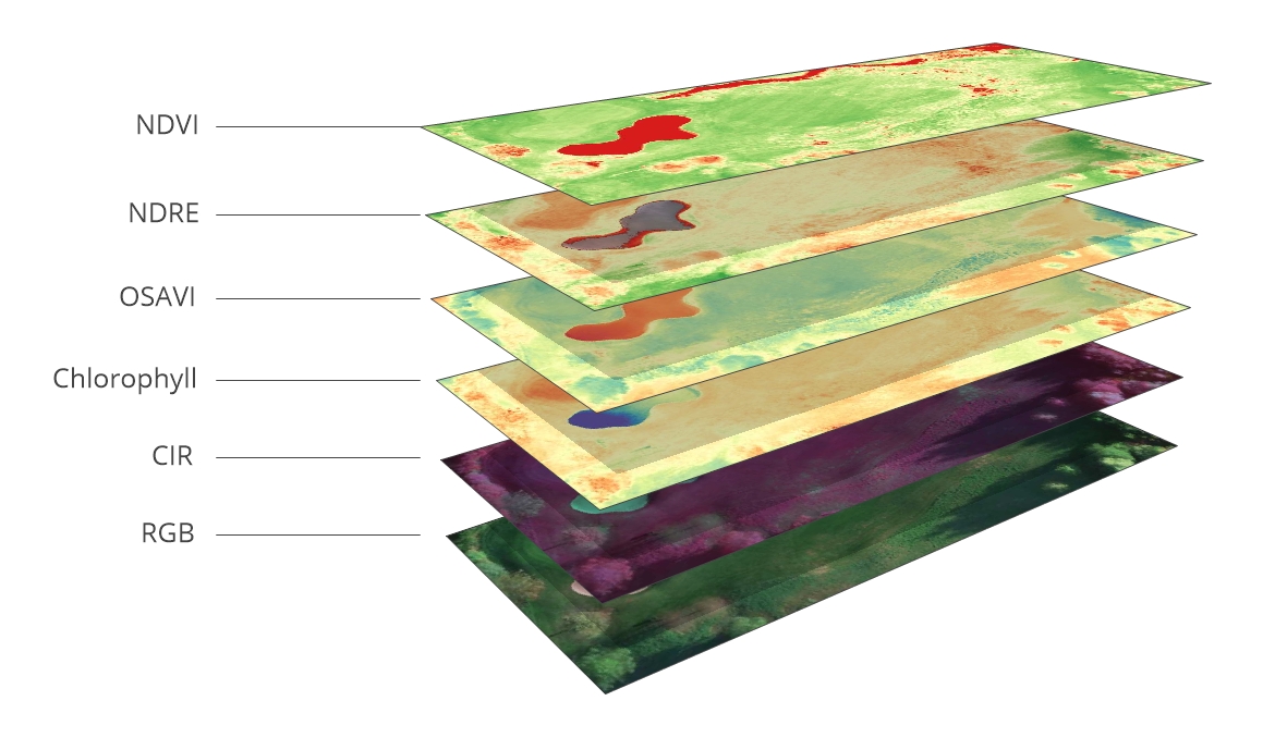
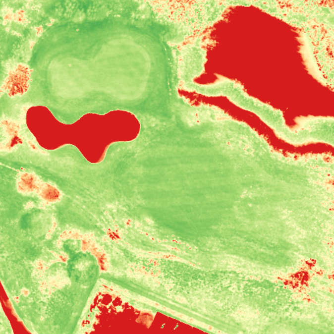
Since there have been satellites man has tried to determine where on earth vegetation is present and where it is not, where it is sick and where it is healthy. The NDVI index, for example, provides information about this and much more. Flying robots equipped with multi-spectral cameras can obtain detailed information on much smaller zones than satellites can.
Vegetations-Indexe übereinander dargestellt.
NDVI

Applications

  • Plant Vigour
  • Differences in soil water availability (in topsoil)
  • Foliaire nutrient content (when water is not the limiting factor)
  • Yield potential
  • Percent of coverage
NDVI Bild
NDRE

Applications

  • Leaf chlorophyll content
  • Plant vigour
  • Stress detection
  • Fertilizer demand
  • Nitrogen uptake
NDRE Bild
OSAVI

Applications

  • Differentiate soil pixels
  • Related to LAI (leaf area index, ground coverage) at some levels where NDVI saturates
  • Accounts for non-linear interactions of light between soil and vegetation
  • Used as a structural index for chlorophyll detection
OSAVI Bild
Chlorophyll

Applications

  • Detect chlorotic crops
  • Plant stress detection
  • Identify vigorous, healthy crops
  • Estimate chlorophyll content
  • Estimate N content (if you know that N is the limiting factor)
Chlorophyll Bild
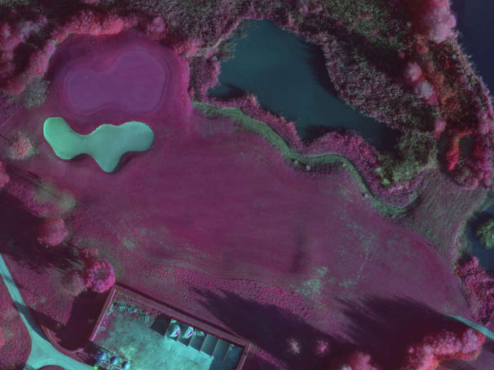
CIR

Applications

  • Assessing plant health
  • Identify water bodies
  • Variability in soil moisture
  • Assessing soil composition
CIR Bild

What's being said about us?

Turfview provided us excellent NDVI Index maps. They are a supporting tool for dry spot detection and an excellent tool for documentation and communication with management.

Pascal Guyout, Head Greenkeeper Golfpark Moossee